核心产品Core Products
-
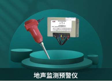
地声监测预警仪
-
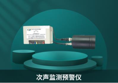
次声监测预警仪
-
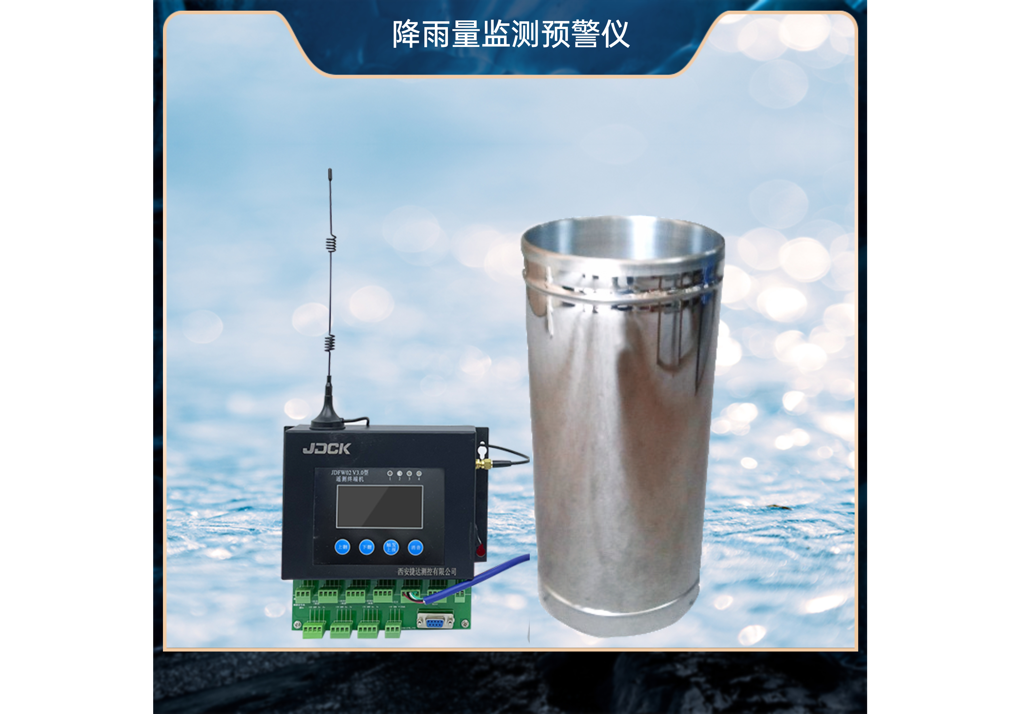
JDFW01型降雨量监测预警仪
-
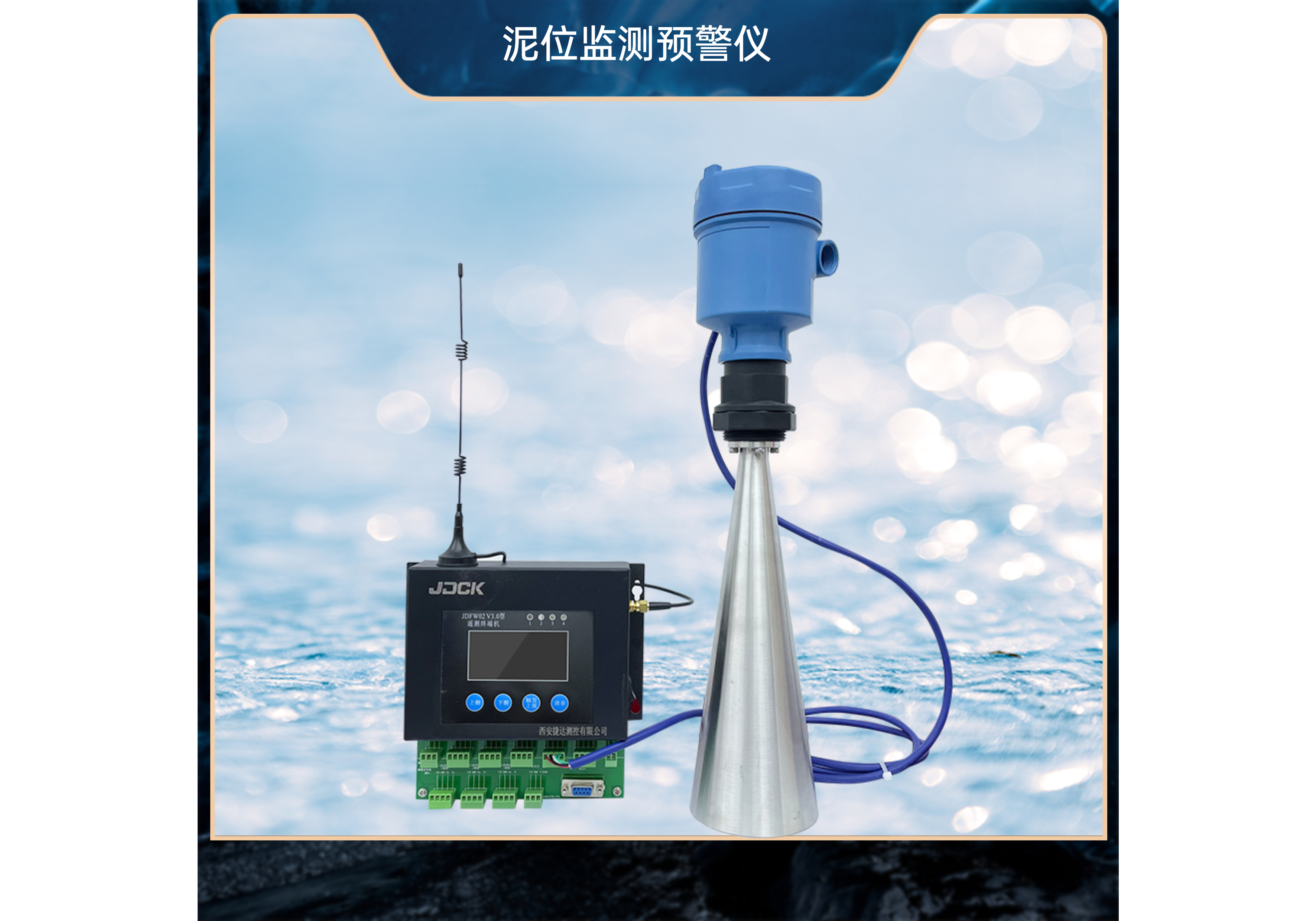
JDFW01型泥位监测预警仪
-
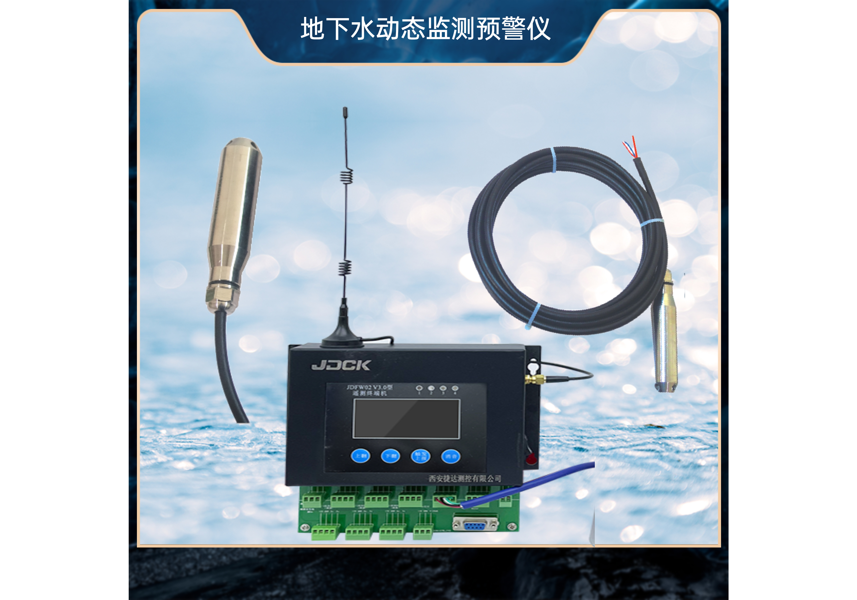
JDFW01型地下水动态监测预警仪
-
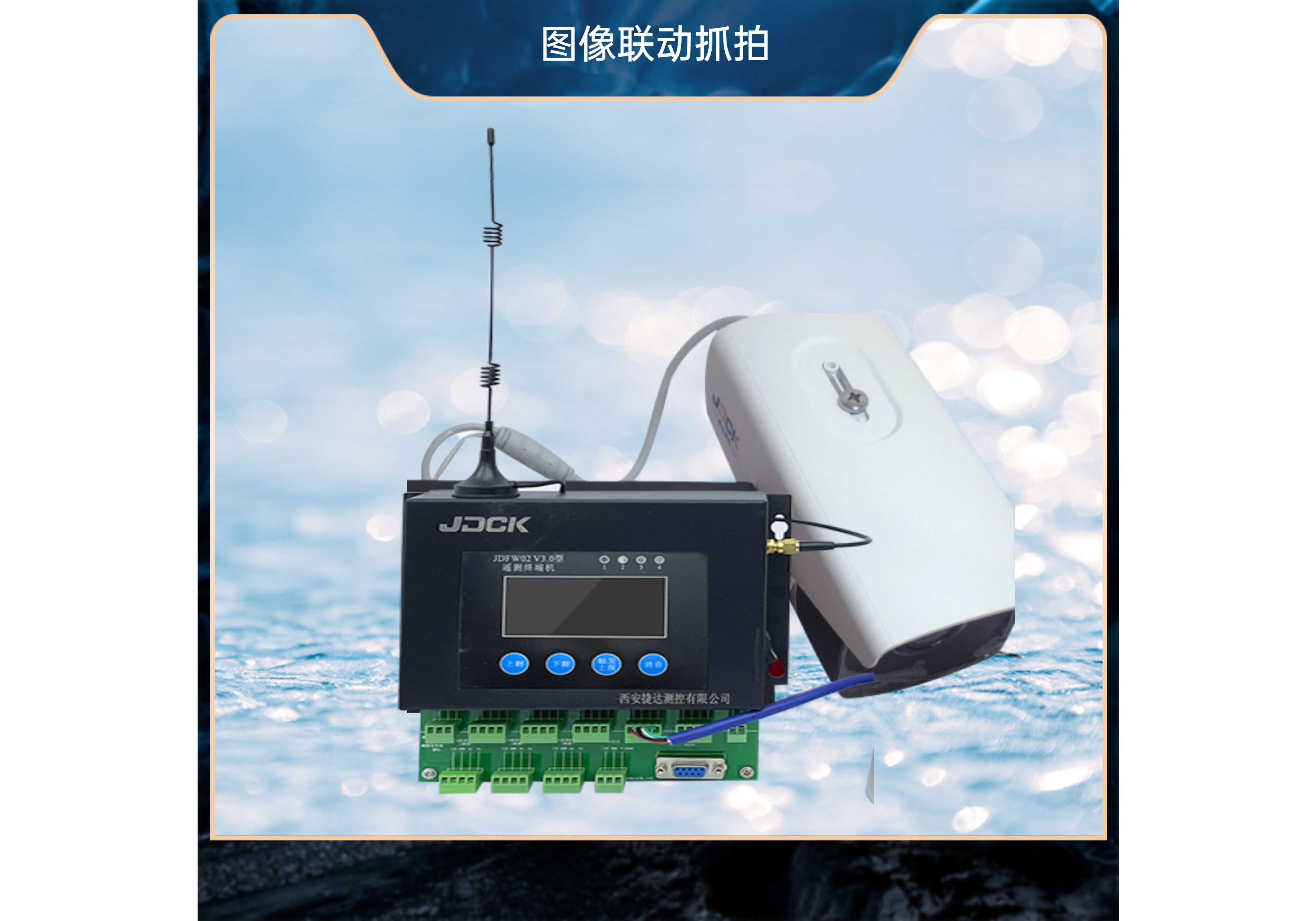
JDFW01型图像联动抓拍
-
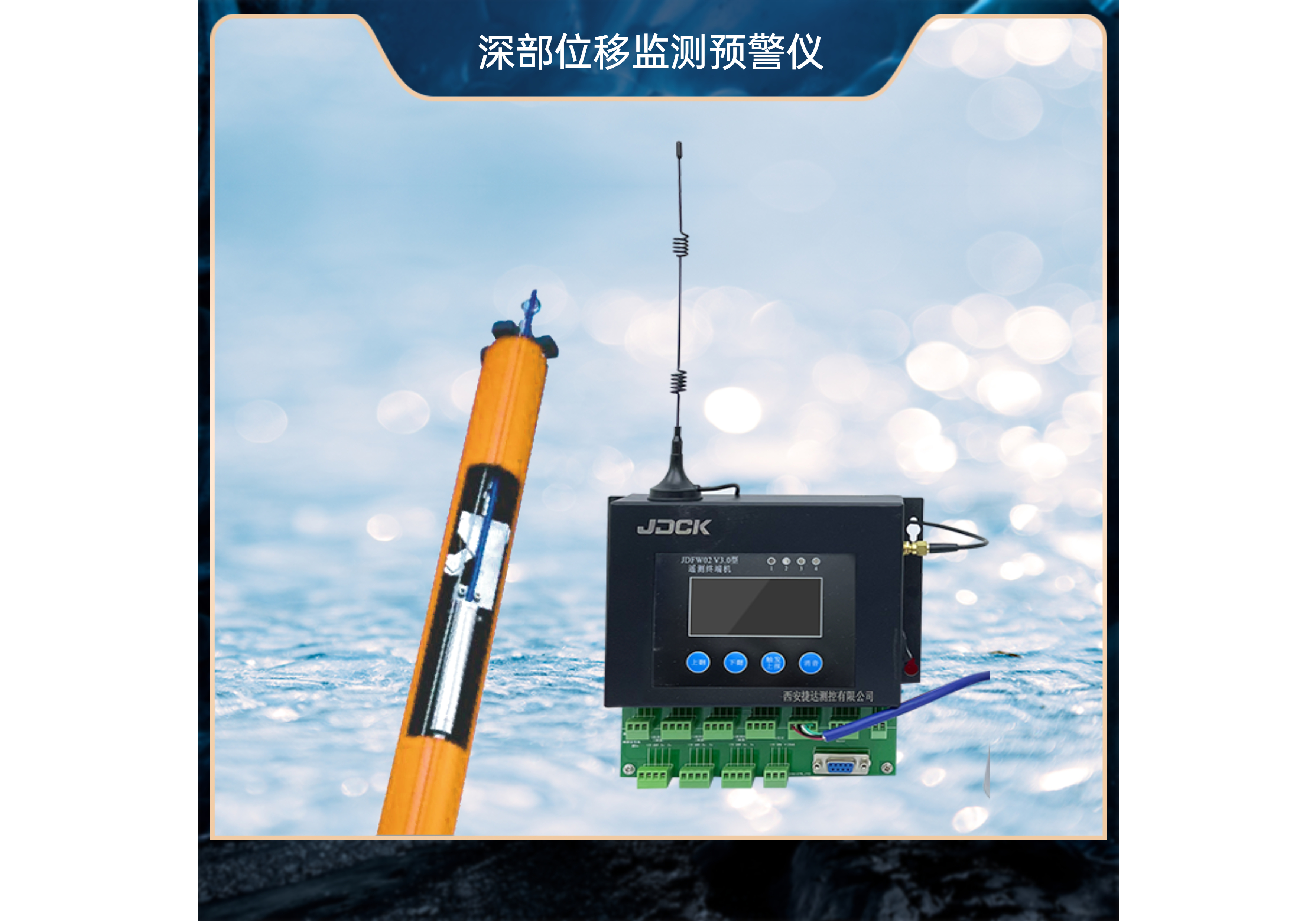
JDFW01型深部位移监测预警仪
-
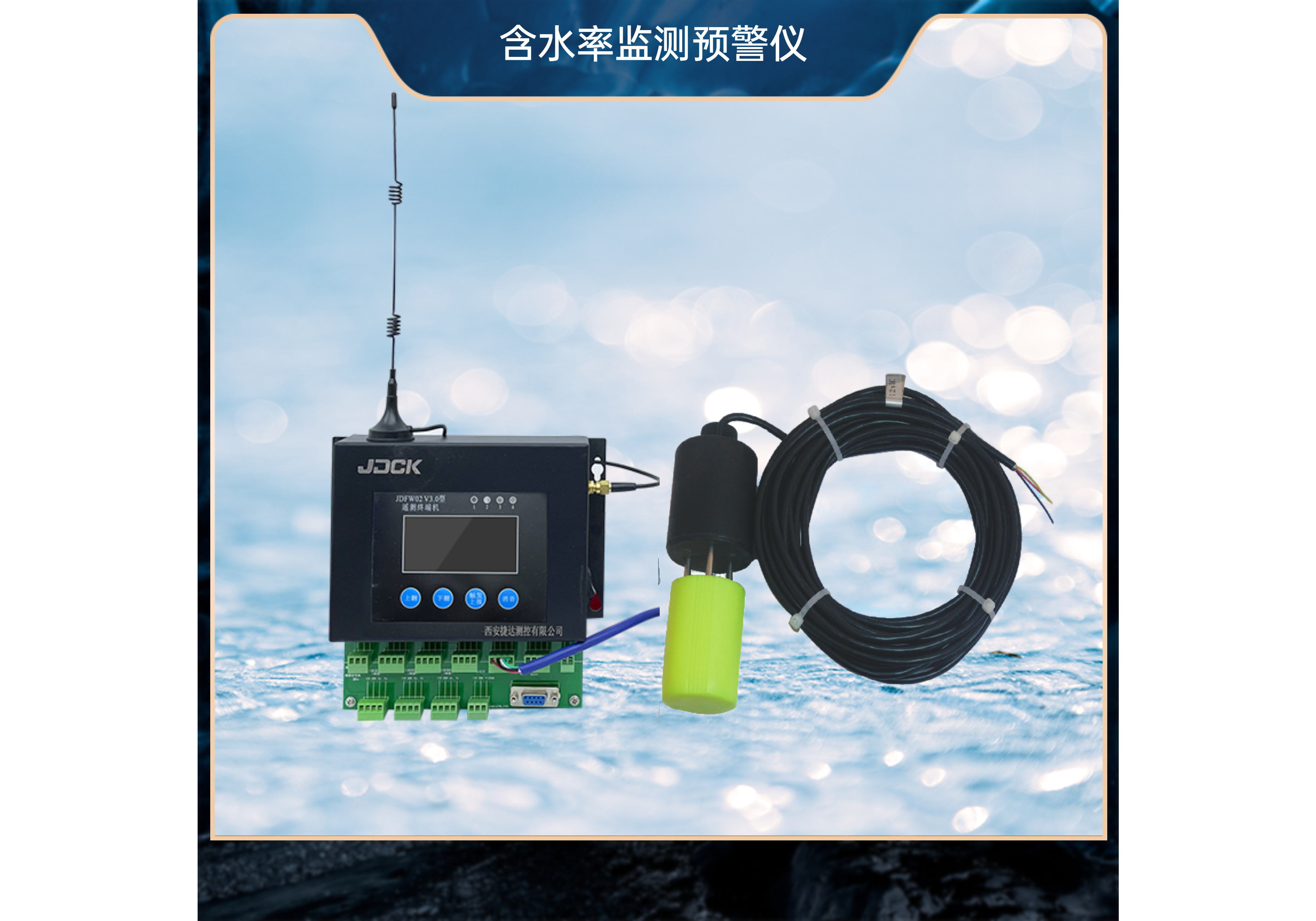
JDFW01型含水率监测预警仪
-

远程预警机
-

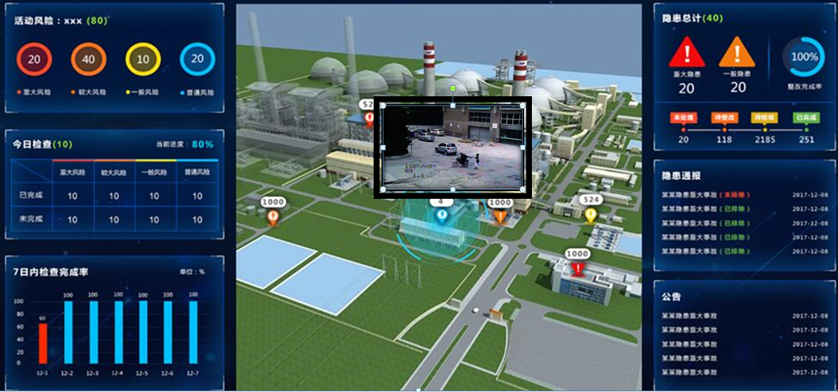
地质灾害信息化平台
-
安全生产双重预防信息化管理系统
-
智能云端选矿管理系统
-
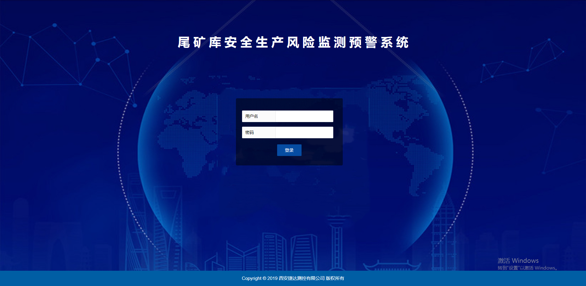
尾矿库安全生产风险监测预警系统
-
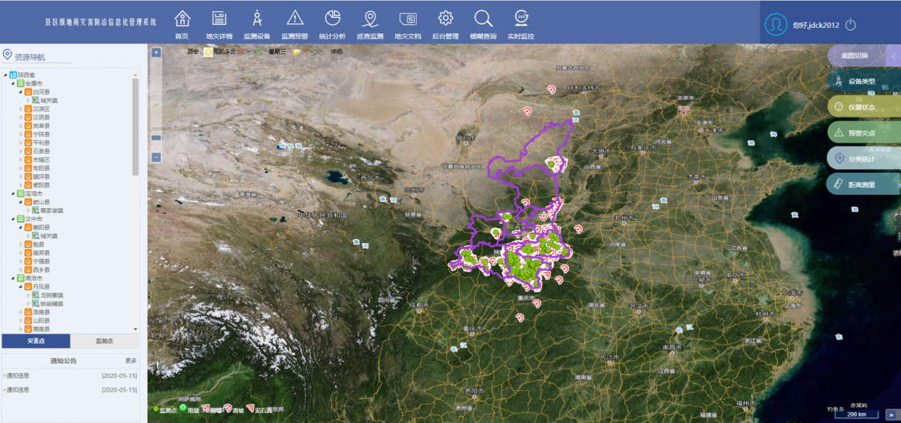
地质灾害防治信息化管理系统
-
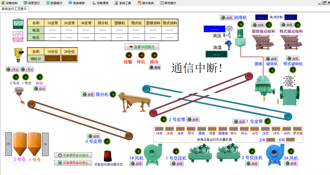
JDITC系列选厂DCS自动化控制系统
-
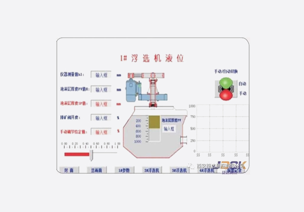
JDITC03V1.0选别作业DCS控制系统
-
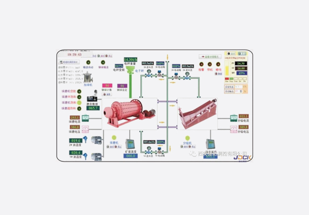
JDITC02V1.0磨矿分级作业DCS控制系统
-
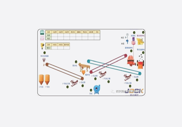
JDITC01V1.0破碎作业DCS控制系统
-
JDITC04V1.0自计加球机
-
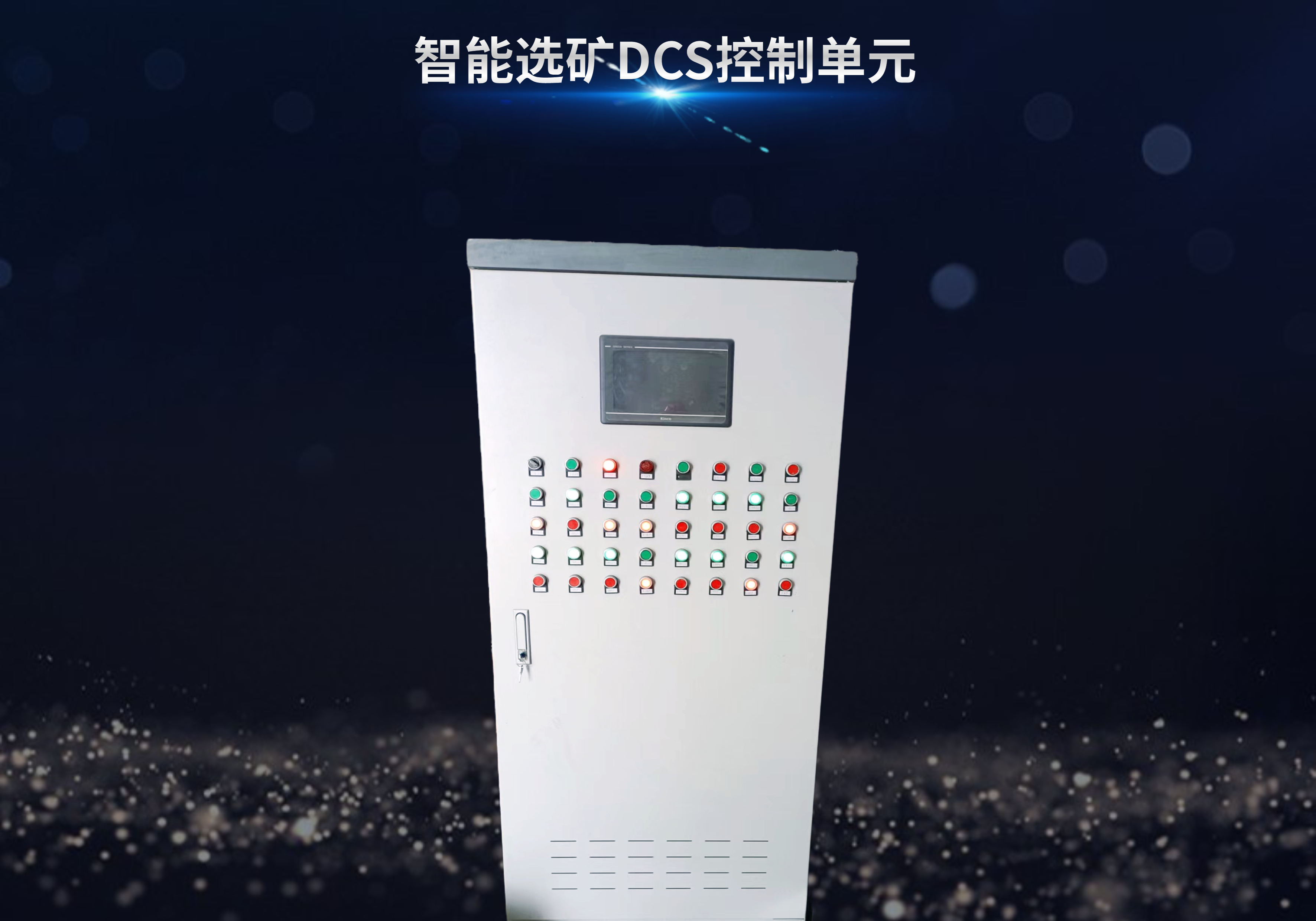
JDITC系列控制单元
公司新闻
科技创新
The 2025 International Conference on Remote Sensing, Geographic Information Technology and Surveying Engineering / 2025 遥感、地理信息技术与测绘工程国际学术会议 (ICRSGITSE 2025) ,主要围绕遥感、地理信息技术与测绘等研究领域展开讨论,旨在为相关领域的研究人员提供一个权威的国际交流平台,通过经验分享和智慧碰撞,推动科研学术成果转化和人才、技术、资本聚集,提升发展新动能。
作者简介
谭锦蓉,女,2020 年毕业于长安大学测绘工程专业,工学硕士。2023 年 2 月入职西安捷达测控有限公司,担任研发中心软件部前端开发工程师职务。任职期间,先后参与智慧田长制网格化管理系统、金堆城露天矿山监测预警系统、海南省地面沉降监管系统等核心项目研发;同时牵头负责AI 算法服务管理平台、地智星大模型在地质灾害点面双控智能防控建设中的研究与应用等科研项目,凭借技术攻关推动科技创新与市场生产经营深度融合,助力公司科研水平稳步提升。
其他作者:张文跃、李博。
论文简介
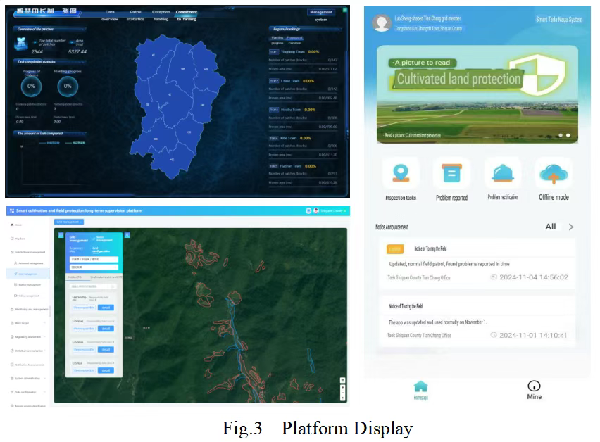
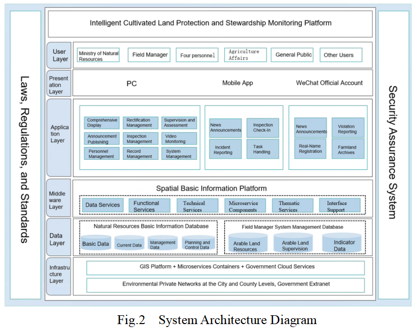
论文题目:《Research and Implementation of an Intelligent Cultivated Land Protection and Stewardship Monitoring Platform》智慧田长制网格化综合管理平台的关键技术研究与系统实现。
该论文以数字化手段为支撑,以耕地用途管制为核心,通过微服务架构、分布式存储搜索技术和关系型数据库相结合方式,确保了数据的实时性、准确性和安全性,实现了耕地相关数据大规模、高并发的存储查询加载和高质量管理,同时基于“人防+技防+制度防”等多重防御机制,综合运用卫星遥感RS、GIS、物联网、人工智能、大数据分析、移动通信等科技手段进行问题耕地的全面、动态、智能识别和监测预警,提高了问题发现的及时性和准确性,提高了人工巡田的效率,降低了人力管理成本。最终通过构建智慧田长制网格化综合管理平台,实现了耕地数据管理、巡田任务管理、异常上报处理、问题核查整改、设备运维、人员管理和责任考核等功能,形成耕地问题的监测、发现、预警、上报、审核、整改、案件处理等一体化工作闭环流程,完善了耕地保护规划和监管,规范了耕地保护的管理流程,强化了部门间的协作和联动,有效提升了耕地保护的规范性、精准性、智能性和高效性。
论文摘要
To prevent and control the "non-agriculturalization" and "non-grainization" of arable land and permanently designated basic farmland, China must comprehensively establish a Field Manager System aimed at the protection of these lands. This platform is supported by digital technologies and focuses on the regulation of arable land use. By integrating microservices architecture, distributed storage and search technologies, and relational databases, the system ensures the real-time availability, accuracy, and security of data. This integration facilitates large-scale, high-concurrency storage, querying, loading, and high-quality management of arable land-related data.
Furthermore, leveraging multiple defense mechanisms—including human defense, technical defense, and institutional defense—the platform employs a comprehensive array of technological methods such as satellite remote sensing (RS), Geographic Information Systems (GIS), the Internet of Things (IoT), artificial intelligence (AI), big data analytics, and mobile communications. These technologies enable the comprehensive, dynamic, and intelligent identification and monitoring of problematic arable land, thereby enhancing the timeliness and accuracy of issue detection, improving the efficiency of manual field inspections, and reducing labor management costs.
Ultimately, by constructing an intelligent supervision platform for the Field Manager System in arable land protection, the platform achieves functionalities including arable land data management, field inspection task management, anomaly reporting and handling, problem verification and rectification, equipment maintenance, personnel management, and responsibility assessment. This integration forms an end-to-end closed-loop process encompassing the monitoring, discovery, warning, reporting, review, rectification, and case handling of arable land issues. Consequently, it enhances arable land protection planning and supervision, standardizes the management processes for arable land protection, strengthens interdepartmental collaboration and coordination, and effectively improves the standardization, precision, intelligence, and efficiency of arable land protection efforts.